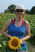
Greni and I off to explore the Finger Lakes National Forest with Cordy, her Icelandic Horse Lysingur and her fancy big rig! The Finger Lakes Forest has real nice horseback riding trails with lots of different type of terrain and elevations. The only downside (could be) is that the Backbone Trail takes about 3 hours and does not really have any short cuts, at least not official ones, we found :)

The Finger Lakes National Forest lies on a ridge-called the backbone-between Seneca and Cayuga Lakes in the Finger Lakes region. New York State's only national forest, this multi-use land is reminiscent of western national forests with a great deal of open land and free-ranging cattle. The forest has over 30 miles of interconnecting trails that traverse gorges, ravines, pastures and woodlands. The forest is managed to provide a diversity of native forestlands, shrublands and grasslands, including areas of native older forests, diverse wildlife habitats, quality recreation areas and forage for livestock (no maps).

From the http://www.cnyhiking.com/BackboneTrail.htm website:
The Backbone Trail begins at the Backbone Horse Campground, and travels in the forest through shrub lands, pastures, old roads and many old homestead sites. It intersects the Interloken and Burnt Hill Trails to the south and the No-Tan-Takto trail to the north. It is a horse trail, however hikers are always welcome to walk the wide path.
It is a relatively flat primitive trail with natural tread, gravel in wet places and mowed paths through fenced pastures. Please close gates behind you. From the north the Backbone Trail can be accessed at the corner of Ball Diamond Road and Wardner Corner Road or at the Foster Pond parking lot. Follow the signs and blaze marks. Caution: Trails are closed to horse users from March 15th thru May 1st due to muddy conditions. (small map on website)
Also from the USDA Forest service:
http://www.fs.fed.us/r9/forests/greenmountain/htm/fingerlakes/links/recreation/seasonal.htm
With a GREAT map (pdf file):
www.fs.usda.gov/Internet/FSE_MEDIA/stelprdb5318997.pdf


No comments:
Post a Comment